Leaving the Pacific behind and following the Fraser Valley toward the mountains.
There is a moment on almost every great road trip when the trip stops feeling like a departure and starts feeling like a journey.
For us, that moment comes east of Vancouver.
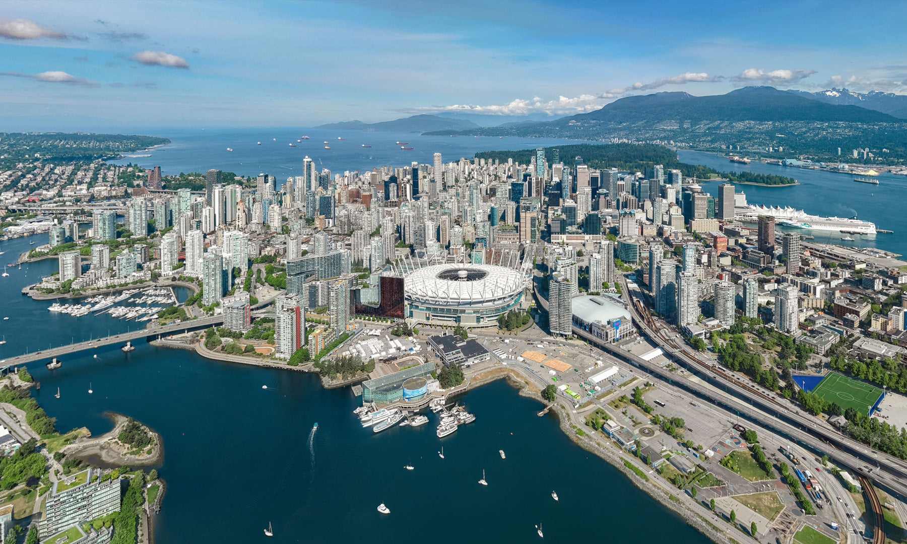
Vancouver begins on Canada’s Pacific coast, a city where ocean, glass towers, forest and mountains seem to occupy the same frame. It is one of the defining images of Canada’s West Coast — and the starting point for a much bigger story.
Our destination is Canmore, in the Canadian Rockies.
But we are not rushing there.
From Pacific to Rockies is about what happens between the two ends of the map: the changing landscapes, communities and everyday experiences that make Western Canada feel so vast and varied.
Part 1 takes us from Vancouver to Hope, travelling east on the Trans-Canada Highway through the Fraser Valley.
It is roughly 150 kilometres, and in normal conditions it can be driven in around two hours. Yet this first stretch deserves more attention than its distance suggests.
Because somewhere between the Pacific and Hope, the city begins to disappear — and the mountains begin to take over.
Vancouver: Where the Journey Begins

Before heading east, it is worth looking back.
Vancouver is unusual because nature never feels very far away. The city sits beside the Salish Sea on Canada’s Pacific coast, with the North Shore Mountains forming a dramatic backdrop across the water. Stanley Park, the seawall, beaches and neighbourhoods are woven into the same landscape.

For travellers beginning a journey across Western Canada, Vancouver represents the first version of the country we will encounter:
Pacific Canada.
It is green, coastal and temperate. The air carries the influence of the ocean. Forests grow almost to the edge of the city. On a clear day, snow can remain visible on mountain peaks while people cycle beside the water below.
Leaving Vancouver on Highway 1, however, the urban landscape gradually begins to loosen.
High-rises become suburbs. Suburbs give way to wider spaces. And then the Fraser Valley begins to open.
That transition is the real beginning of the road trip.
Into the Fraser Valley
The Fraser Valley is not simply the space between Vancouver and the mountains.
It is one of the landscapes that helps explain British Columbia.
As Highway 1 continues east through the Lower Mainland, the road passes communities including Langley and Abbotsford before reaching Chilliwack and, eventually, Hope.
The visual change is gradual at first.
Buildings become less dense. Fields become larger. Barns, greenhouses and farm roads appear beside the highway. Depending on the season, the valley can feel intensely green, golden and dry, or wrapped in low cloud and rain.
And all the while, the mountains seem to move closer.
Only a short drive from Metro Vancouver is a major agricultural landscape. Dairy farms, berries, vegetables, poultry and other agricultural activities are part of the Fraser Valley’s everyday economy and identity.
For a road traveller, the contrast is immediate: one morning can begin among Vancouver’s towers and waterfront paths and continue through open farmland beneath enormous mountains.
That combination — city, agriculture and wilderness compressed into a relatively short distance — is distinctly British Columbian.
Abbotsford to Chilliwack: The Mountains Move Closer
Past Abbotsford, the drive begins to feel increasingly rural.
By Chilliwack, the mountains no longer seem like a distant backdrop. They form the walls of the valley.
This is a good place to slow the journey down.
Chilliwack and the surrounding valley offer an opportunity to step away from the highway rhythm: stop for coffee, visit a farm market when in season, or simply take a short break and look at the geography around you.
The Fraser Valley is also a reminder that some of the best Canadian travel experiences are not famous attractions.
Sometimes they are ordinary things:
a roadside produce stand, a field beneath a mountain, a small-town café, a river glimpsed from the road, or clouds lifting from a forested slope after rain.
These are the details that turn a route into a memory.
The Road Narrows Toward Hope
East of Chilliwack, the character of the journey changes again.
The broad agricultural valley begins to tighten. Mountains become steeper and more dominant, and the sense of entering the interior of British Columbia grows stronger.
Then comes Hope.

Hope occupies an important position in the geography of the province. It sits near the eastern end of the Fraser Valley, where major routes begin to separate toward very different parts of British Columbia.
From here, travellers can continue through the Fraser Canyon, take Highway 3 toward Manning Park and the southern Interior, or climb Highway 5 toward Merritt and Kamloops.
That is why Hope feels less like an endpoint and more like a gateway.
For our Pacific-to-Rockies journey, it marks the end of the first chapter.
Behind us: Vancouver, the Pacific Coast and the broad Fraser Valley.
Ahead of us: mountain passes, the Interior, lakes, small towns and eventually the Canadian Rockies.
Don’t Just Drive Through Hope

Many travellers treat Hope as a fuel stop.
It deserves a little more time.
A short walk through town reveals a community surrounded almost completely by mountains. Hope is also known for its chainsaw carvings, while the surrounding area opens access to rivers, trails and dramatic mountain scenery.
Even without adding a major attraction, an hour or two in Hope is enough to change the pace of the day.
Park the car. Walk. Find coffee or lunch. Look back down the valley you have just crossed.
Then look toward the mountains ahead.
A Simple Vancouver → Hope Road-Trip Plan
| Route | What to notice |
|---|---|
| Vancouver → Langley / Abbotsford | The city gradually opens into the Fraser Valley |
| Abbotsford → Chilliwack | Farmland, local agriculture and increasingly dramatic mountain views |
| Chilliwack → Hope | The broad valley narrows and the mountains begin to surround the highway |
| Hope | Allow 1–2 hours for a walk, lunch and a slower look at this mountain gateway |
Driving note: Travel times vary with Lower Mainland traffic, construction, weather and season. Check current road conditions before setting out, especially if continuing beyond Hope into mountain highways.
Why This First Leg Matters
Vancouver to Hope is not the most dramatic section of the journey.
That comes later.
There will be higher passes, larger lakes, glaciers and landscapes that seem almost impossible in scale.
But this first drive establishes the rhythm of the entire route.
Western Canada does not change all at once.
It changes gradually.
Ocean becomes river valley. City becomes farmland. Farmland becomes forest. And the mountains that were once on the horizon eventually surround the road.
That is the story we are following.
Not simply Vancouver to Canmore, but one landscape becoming another.
Take a Piece of the Journey Home
Travel memories often attach themselves to a place: a walk around Stanley Park, an afternoon at Granville Island, a Vancouver skyline, or simply the feeling of beginning a journey on the Pacific Coast.
BCgift’s Vancouver & BC Magnet Collection turns some of those places into small, travel-friendly keepsakes.
Explore: Vancouver Fridge Magnets & BC Souvenir Magnets
If you are choosing a souvenir by the place you remember, see our guide:
Read: How to Choose a Vancouver Magnet: Landmarks, Motion and Gift Ideas
Or, for compact gifts that are easy to bring home:
Read: Small Vancouver Gifts That Are Easy to Pack and Worth Bringing Home
Next Journey
Part 2 — Beyond Hope
Hope is where the first chapter ends.
Beyond Hope, the routes climb into increasingly mountainous country and the landscape begins another transformation. The green Fraser Valley falls behind as the journey moves deeper into British Columbia’s Interior.
*Coming next in From Pacific to Rockies: Part 2.*
FROM PACIFIC TO ROCKIES
Vancouver → Hope → British Columbia Interior → Columbia Mountains →
Canadian Rockies → Canmore
Ocean. Valleys. Lakes. Mountains. One unforgettable journey.
Explore Canada. Remember the Journey.
Photo Credits and Licensing
All five photographs used in this article are web-display derivatives. The immutable original files remain unchanged.
- Skyline of Vancouver, Canada.jpg — Photo: Quintin Soloviev / Wikimedia Commons / CC BY 4.0. Resized by BCgift to a maximum dimension of 1800 px for web display; no crop or other content edits.
- Vancouver skyline from water taxi (30403134737).jpg — Photo: Thomas Quine / Wikimedia Commons / CC BY 2.0. Resized by BCgift to a maximum dimension of 1800 px for web display; no crop or other content edits.
- Stanley Seawall.jpg — Photo: Bobanny / Wikimedia Commons / Public Domain. Resized by BCgift to a maximum dimension of 1800 px for web display; no crop or other content edits.
- Fraser River Hope.jpg — Photo: Emma0mb / Wikimedia Commons / CC BY 4.0. Resized by BCgift to a maximum dimension of 1800 px for web display; no crop or other content edits.
- Wallace St Hope BC.jpg — Photo: Emma0mb / Wikimedia Commons / CC BY 4.0. Resized by BCgift to a maximum dimension of 1800 px for web display; no crop or other content edits.
.jpg)


